

by Min Li Chan
Tim De Chant, in his blog Per Square Mile, considers income inequality from space by contrasting Google Earth images of adjacent neighborhoods of different income levels. The results are striking and provocative. In one instance, affluence evokes order over chaos:
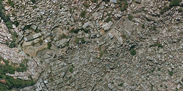
Rochinha, Rio de Janeiro
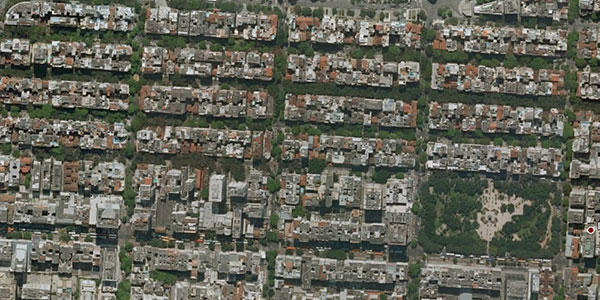
Zona Sul, Rio de Janeiro
In another case, affluence seems to liberate residents from the grid, to carve out living spaces more organically:
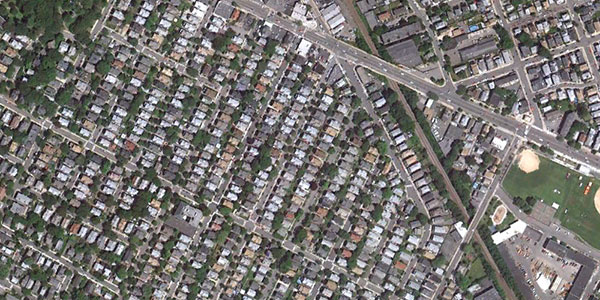
Ball Square, Somerville, Boston Metro Area
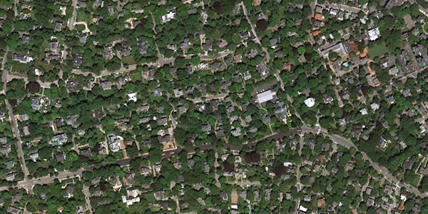
West Cambridge, Boston Metro Area
De Chant observes that in all his examples, and those curated from his readers, the prevalence of urban trees signaled greater wealth in the area. Taking the ten thousand foot view, one can posit urban trees as the impact of local tax dollars manifested, bringing to mind the political and commercial mobilization of power that more affluent communities wield.
As I peered through a plane window over the outskirts of Las Vegas last week, I wondered what the bird's eye view pictured above might foreshadow.

Source: Min Li Chan
Credits: All images from Google Earth via Per Square Mile unless otherwise noted in the captions.
+ share
Tim De Chant, in his blog Per Square Mile, considers income inequality from space by contrasting Google Earth images of adjacent neighborhoods of different income levels. The results are striking and provocative. In one instance, affluence evokes order over chaos:
Rochinha, Rio de Janeiro
Zona Sul, Rio de Janeiro
In another case, affluence seems to liberate residents from the grid, to carve out living spaces more organically:
Ball Square, Somerville, Boston Metro Area
West Cambridge, Boston Metro Area
De Chant observes that in all his examples, and those curated from his readers, the prevalence of urban trees signaled greater wealth in the area. Taking the ten thousand foot view, one can posit urban trees as the impact of local tax dollars manifested, bringing to mind the political and commercial mobilization of power that more affluent communities wield.
As I peered through a plane window over the outskirts of Las Vegas last week, I wondered what the bird's eye view pictured above might foreshadow.
Source: Min Li Chan
Credits: All images from Google Earth via Per Square Mile unless otherwise noted in the captions.
+ share
