polis: a collective blog about cities worldwide

Cities and Degrowth

by Melissa García Lamarca

This past 26-29 March Barcelona hosted the second international conference on economic degrowth for ecological sustainability and social equity, attracting hundreds of people from over 40 countries to learn about and collectively explore the subject. Faced with the multiple and complex challenges of climate change and social inequities (among others) due to Western consumption patterns, degrowth is about a voluntary reduction of the size of the economic system, proposing a framework for transformation to a lower and sustainable level and mode of production and consumption. Alongside this reduction of scale, degrowth is also about decolonising the imaginary, shifting values from ‘more is better’ towards qualitative relations and behaviour, as well as decommodifying and pushing back the market rationality that dominates most societies around the world.

While the first international conference in Paris in April 2008 explored and proposed in essence this sort of a paradigm shift, largely through panel discussions and paper presentations, the heart of the Barcelona conference laid in 30 interactive working groups, each on an important topic related to economic degrowth for ecological justice and social sustainability. These working groups were tasked with collectively developing the important research and political proposals to move the degrowth agenda forward in various areas, from topics ranging from work-sharing, property rights and basic income/income ceilings to agro-ecology/food sovereignty, demography and cities.


With a diverse group of about 20 people from different backgrounds, countries and languages, the working group on Cities and Degrowth proved to be a challenging topic and conversation, starting from the basis of defining how a ‘degrowth’ city is different from an ecological or sustainable city. A wide range of issues were discussed, from infrastructure, city sprawl, resource production and consumption, urban agriculture and green spaces to having diversity while maintaining cultural identity, bottom up driven urban planning and if urban population limitation is compatible with the degrowth agenda – with concerns expressed over potential Malthusian interpretations of such issues. While there was general agreement on the need for example to roll back sprawl, remove automobile dependent development, create multifunctional spaces, generate energy locally and through small-scale sources, there was uncertainty on if degrowth equates to limits on urban densities or what to do about the control and power of developers. Were we talking about post-capitalist space? Or at least post-neoliberal spaces? Furthermore it was recognised that context is critical, as solutions for the ‘North’ are likely not the same as the ‘South’, and that scale, from town to megacity, must be taken into consideration.


The two political proposals, among over half a dozen, that emerged as priorities from the session included to 1) reshape and reform current cities instead of building (eco)cities and (eco)neighbourhoods from scratch and 2) to relocalise urban life with multifunctionality (i.e. public space as a commons) in mind. The two research proposals include the need to explore how the decentralisation of political power in the city relates to bottom-up processes and the degrowth agenda, addressing concerns around democracy and the concentration of power, and how Lefebvre’s right to the city – the right of all urban dwellers to take part in the production of the city, transforming social, political and economic relations in urban spaces – connects to degrowth.

So how do you think cities will look after degrowth? Can we plan for degrowth, and if so how (multifunctional urbanism, etc.)? The discussion continues, as most of us left with many more questions than answers.

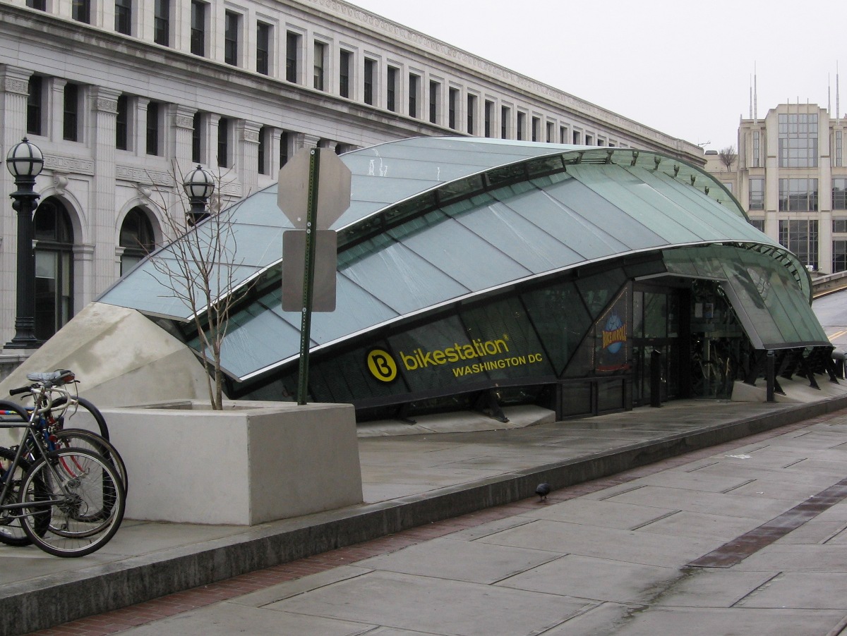
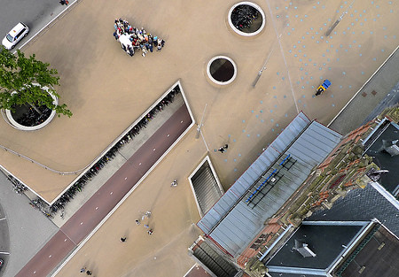
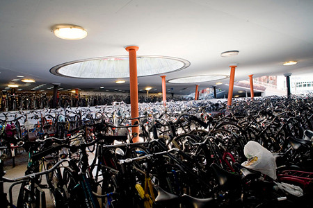
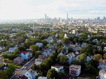
Credits: Photos by Melissa García Lamarca.

The City in Abstract

by Brendan Crain

What does the city look like, in your mind's eye. The internet has made visual communication the dominant mode as we have become more reliant on imagery to help us absorb ever more information at ever increasing speeds. How does this affect the way that we understand the urban form? As physical cities grow more visually diverse, their representations will follow suit. At some point, cities can begin to look more like abstractions than actual abstractions of cities. When viewing the following selection of images, make a quick first pass, and then go back and look again. Were the abstractions you saw really abstractions? And were the cities you saw really cities?


And now, again: What does the city look like in your mind's eye?

Brendan Crain is the founder of where and eighthsofamile.

Credits: Images from the Where FFFFOUND Archive.

From Conversation to Development: Spontaneity in Informal Mumbai

by George Carothers

The beauty of the informal settlement is that it embodies everything associated with informality. This comes in the form of informal economy, informal policing, and informal development, among many other things. The absence of any formal planning authority, for example, allows residents to take full control over proposed developments and buildings. Some sort of neighbourhood consultation may take place, or may not, but in every way the development agenda is built from the ground up.


I recently spoke with a property owner in Dharavi who is in the process of converting an old site into a space for children to congregate and participate in various after-school activities. His dream of a youth community centre came true after he “informally inherited” a property down the street. He approached URBZ to collaborate on this concept several months ago, and ever since there has been an endless river of support for the project by residents and outsiders who are waiting to get involved.


The interest has meant one thing: a need for expansion.

Space is tight in Dharavi. There is little room to move from side to side, and so residents make do with rearranging the space that they have. With interests of expansion in mind, the immediate vicinity and everything connected to it become vulnerable to the owner’s plans.

On Day One a discussion took place with regards to a small house at the front of the site. Rather than evict the residents, the house would be annexed and the back half would become an office, attached to the youth community centre, while the front would continue to be a house. Although the resident of the house was somewhat distraught over the halving of his home, an agreement was reached and the idea was put into practice. Quickly.


On Day Two, the house was annexed. Builders moved in with bricks, mortar and trowels, and within a few hours the wall was almost raised.


On Day Three, one house had become two, and after cementing the new barrier, the workers moved to the back of the site to start building an entirely new structure. The final designs and use for the building in the back are anyone’s guess.


Documenting and following the method and madness of development in the informal settlement is an incredible learning experience. When we compare this to the processes of conceptualizing, drawing, planning, submitting, approving, and building, the informal method showcases how the streamlining of place-making creates exciting and continuously evolving spaces.

Credits: Photos of Dharavi by George Carothers.

Why the Sanitation Crisis Can't Be Solved Without Communities

by Katia Savchuk


Source: Pranav Singh

More than half of India's population defecate in the open, according to the latest statistics from the World Health Organization and the United Nations. A report released this month reveals that 638 million Indians (54 percent of the population) lack toilets. In Mumbai, the nation's biggest metropolis, residents of informal settlements have to share a single toilet with an average of 80 other people; in some places, there is one toilet for every 273 people. Needless to say, some don't make it to the front of the line.


Source: Katia Savchuk

In light of this sanitation crisis, I could hardly contain my shock when I came across four double-decker toilet blocks in Krishna Nagar in Mumbai — one on every corner of an intersection. It was like an oasis in a desert. Towering over the vegetable carts and modest dwellings around them, they were the most impressive structures in the neighborhood. This was toilet heaven.


Source: Katia Savchuk

I was accompanying leaders of the National Slum Dwellers Federation (NSDF) as they completed a community-based survey of toilets in the Mumbai's slums. Born in Mumbai in the mid-1970s, NSDF organizes slum residents across India to resist evictions and secure adequate shelter and sanitation.  Today, NSDF has a membership of more than half a million households. It works in an alliance with an NGO and a network of women's collectives and is part of Shack/Slum Dwellers International.

Although the community leaders I accompanied were in the trenches of the toilet wars, they did not seem surprised by the toilet surplus we had chanced upon. They had seen it all as far as bureaucratic ineptitude and turf battles for local voting blocks were concerned.


Source: Katia Savchuk

NSDF was gathering data for the Mumbai Metropolitan Region Development Authority (MMRDA), which has taken the lead in encouraging the involvement of nonprofits and community-based groups in addressing sanitation. Toilets may not seem glamorous, but when there is a scarcity, they become hot political commodities. When sanitation provision is left exclusively to bureaucrats, local politicians and commercial contractors, more toilet hells than heavens result, not to mention siphoned-off cash and maintenance breakdowns.

MMRDA is taking a community-based approach in one of the country's largest urban sanitation projects, which will construct 30,000 seats across 11 cities in the region in its first phase and 100,000 seats over the next two years; 11,798 seats were complete as of December 2009. Mainly slated for major arterial roads, highways and public places, the project involves nonprofits and community partners in planning, design, construction, operation and maintenance of  public toilet blocks.


Source: Katia Savchuk

The prioritization of community involvement was based on the success of previous citywide sanitation projects led by the Society for the Promotion of Area Resource Centres (SPARC), a Mumbai-based NGO that has supported slum dweller federations across India for over twenty years.  SPARC had demonstrated the benefits of community-designed, built and managed toilet blocks through more than a decade of work in slum sanitation and has undertaken major community toilet programs in partnership with the government in Pune and Mumbai.

As in previous initiatives, community involvement in the current project has faced objections from private contractors feeling left out of profits and sabotage by local politicians fearful of losing their patronage relationships with slum populations. At the same time, grassroots leaders have had to learn along the way as they take on projects at unprecedented scales. It's not easy, but the latest sanitation technologies or planning methods cannot substitute for the participation of community-based organizations in building toilets where they're needed.

+ share

Networked Ecologies of Los Angeles

by Andrew Wade


Over the spring and summer months, polis will be participating in the mammoth-organized group reading of The Infrastructural City: Networked Ecologies in Los Angeles, edited by Kazys Varnelis. This experiment in the collective discussion of a text will be all the more invigorating as new people join the conversation, so we encourage our readers to join us and add new perspectives. The discussion of chapter one will not begin until Monday, April 26, so please find a copy in the next few weeks and follow along. Details of content and proposed reading schedule may be found here. We hope you join us!

Credits: Image of Terminal Island from Lane Barden.

Tokyo Subway Dreams

by Vivien Park


I've been thinking a lot about the idea of transition lately, in particular our times in transit. So when I came across these ethereal photographs by Michael Wolf, I was immediately drawn to his ability to capture the moments when time seem to pass by at a different speed. Trapped in an in-between world, the expressions on these commuters are of loss and longing. What are they dreaming of? Who are they dreaming of?

Credits: Photos by Michael Wolf.

Assorted Links #7

Bicycle Stations from Around the World

by Natalia Echeverri

Nearly every biker I know has had their bicycle stolen at least one time in their life. One of mine was stolen last year. Actually, thousands of bikes are stolen a year in the US. Kryptonite lock, releases a yearly list of the 10 wost cities for bike theft. Philadelphia, Chicago, New York and San Francisco are the worst four. Several studies imply that fear of bicycle theft discourages many riders. Some of them give up biking permanently after having their bike heisted.

With biking booming in many cities around the world, secure storage facilities are becoming essential. In the past decades cities have invested in bicycle paths as a process to increase bike commuting and reduce automobile usage, but little attention has been given to storage systems until recently. Instead of of using the typical bicycle cages and parking slabs cities are turning to a new typology of architecture which can give identity and encourage more bicycle commuters.

In Washington DC a new bike station opened recently at Union Station with a storage capacity of 150 bikes. It offers rentals, changing rooms and lockers.


Millennium Park Bike Station stores 300 bikes. It has showers, changing rooms, lockers, bicycle rentals, a bike repair station, a cafe that opens during the summer. There is a long waiting list to obtain a stall.


The Biceberg is an automatic bicycle parking happening in several cities around Spain. By using a chip card, it takes the user 30 seconds to store and retrieve the bike. The Bicebergs vary in size and capacity.


In Groninger, Netherlands the bike parking structure sits in front of the train station. It has a capacity to store 4000 bikes and is an interesting public architecture.


Tokyo's automatic large scale parking can hold 9400 bikes.


Credits: Image of _bike tree from Reinventing the Bike Shed student competition. Image of Kansai Statio, Tokyo from bakfiets-en-meer.nl. Image of biceberg section from www.cooltownstudios.com. Image of Biceberg from www.neo2.es. Image of Bike Station DC interior by jpchan and dendroica cerulea. Image of Millennium Park Bike Station from www.greenbeanchicago.com.

Deciphering Simone Part 1: Beginnings

by Hector Fernando Burga


AbdouMaliq Simone is an urbanist and professor of Sociology at Goldsmiths, University of London. Since 1977 he has held different professional and academic positions across Africa and Southeast Asia, in the fields of education, housing, social welfare, community development, local government and international development. His best known publications are In Whose Image: Political Islam and Urban Practices in the Sudan and For the City Yet to Come: Urban Change in Four African Cities. Hew newly published book is entitled Movement at the Crossroads: City Life from Jakarta to Dakar.

This interview was originally conducted for the Berkeley Planning Journal v. 22, in the summer of 2009. In this and the following posts, it will be republished under the headings: Beginnings, Method and Practice. This interview is posted in Polis with the permission of AbdouMaliq Simone and the editors of the Berkeley Planning Journal.

How did you become interested in writing about African cities?

I spent a large part of my childhood in Freetown, Sierra Leone, in a kind of situation which was fairly folded in a parochial community, a network of people who didn’t have a lot of money. They couldn’t spread themselves out into the surrounding urban area. So there was this kind of mixed existence; being part of a complicated neighborhood, but also being apart and withdrawn from the city and folded in a network of schools and institutions, a kind of expatriate community that didn’t have a lot of money and had precarious status. In some ways this is how I grew up and later on in late adolescence, early adulthood, I escaped back to West Africa. It was at that moment that I revisited these memories and began to have an interest in African cities.

You received a degree in psychology here in the Berkeley area, correct?

Yes at the Wright Institute.

Yet, eventually you entered the world of development practice.

Yes.

Was that something that happened by chance? Or was it an engagement based on prior experiences?

I dropped out of university after one semester and had some personal connections in the world in psychiatry. I had to do something and this was it. But the kind of institutions in New York, the kinds of networks I was involved with, were very much oriented toward community psychiatry. At that moment in American psychiatric history there was a great deal of focus on working on localities and social networks. My first jobs were in this kind of inter-sect oral, interdisciplinary work, in urban areas of the Bronx and Brooklyn. When I decided to leave the professional practice of clinical work this phase represented a touchstone, an orientation that I could come back to. Issues of housing and local economic development, which during the 1970’s, were major issues in psychology became less dominant as time went on.

But the City as a topic was not necessarily something that you thought about as a central subject? You are recognized as an urban theorist and when we read your work you produce urban theory. How did the city become a scope, a framework, a scale, a source of analysis?

I think the formative work around this question occurred when I was asked by various Muslim social welfare organizations to think about what was taking place with Muslim residents in cities in West Africa countries. Particularly in Cote d’Ivoire, Sierra Leone, Ghana, Burkina Faso, Nigeria, where Muslim residents seem to be marginalized in various dimensions of their everyday lives. Even though in all of these countries you had very strong professional religious-political networks, there was something about the way in which many of the residents didn’t fully come to grips with their possibilities of being in the city. So there were several projects over a period of years, from the 1970’s to the 1980’s, where I collaborated in coming up with new concepts of schools, new concepts of neighborhood organizations, new ways of intensifying and extending the engagement of a particularly kind of majority in Muslim neighborhoods in cities such as Abidjan and Accra. In this respect, I think that I was trying to rethink the way in which spaces, histories, and precedents were articulated into a larger system. Then I began to think about what kind of system it actually was. So I think that was the key issue. I also taught at different African universities. I was teaching psychology formally, but often times these universities were closed down for a variety of reasons, so I had to find other ways to make money, other things to do.

Credits: Image of AbdouMaliq Simone from Goldsmith University London.

Yes, But in North America We Don’t Call Them Suburbs

by Alex Schafran

Since Katia ended her last post with a question, it only seemed appropriate to attempt to answer it. And since I am feeling full of hubris, I will take a shot at Kevin Drumm's question as well. The short answer to both is that history shows that history demands slightly different questions. Let me explain, in reverse order:


Planning ideals v. powerful players (Katia's question): For better or for worse, these two things are intertwined. You have to remember that in the history of zoning in the United States, big business and large developers largely wrote the code. Although we may think of developers as being anti-regulation, the major institutions of planning and zoning in the US were set up by developers in order to weed out unscrupulous rivals and reduce uncertainty in the marketplace. Although there was no lack of racist populism in the early experimentations in California with anti-Chinese zoning in the late 1800's, by the turn of the century realtors, developers, planners and architects were all behind the effort to regulate our environment. These powerful interests and the (former) ideals of planning were unified. The difficulty is that they became very popular, and a new generation is now forced to attempt to convince both the masses and an entire industry that the previous ideals weren't ideal. So this is about new ideals v. old ideals as much as ideals v. power (or ideals v. populism, as with Drumm). If you don't believe that much of the old way is still the ideal in some planning circles, go to an APA conference.

Do Walkable, High-Density Suburbs Exist? Surely, we just don't call them suburbs. We call them cities, even if they have suburban functions. Take Oakland or Jersey City for example, places where many people commute into the major city (and which have almost always had some sort of economic dependence on the larger city), but where you can live in a more urban context. There are some examples of places where you are seeing increasing walkability, transit access and employment in former bedroom communities - look at Walnut Creek or Evanston or Pasadena - which are now caught between city and suburb.

The key here is a more historical understanding of how urbanization in the US has happened. None of the big cities were planned as such, with the exception of Washington DC. They started small, and slowly grew. Surrounding towns grew into suburbs, and some into small cities in their own right. Unlike many other countries, most of America's suburbs and cities weren't formally (or entirely) master planned, but were built by planners and developers subdivision by subdivision, general plan by general plan, so that you often have many layers and levels of urbanization - denser more urban spaces near the core and near transit, suburban spaces farther out, and more exurban and rural places on the fringe. You can see this "transect," to steal a term from the New Urbanists, even in little exurban towns like Patterson, CA, whose general plan is above. It is all a result of certain politics of growth where towns are usually progrowth until they have all the amenities that make them suburbs, and then become anti-growth before they become cities. It is that last hurdle which is toughest, this is where Drumm's populism thesis is right on - over the past half century, suburbs have used planning and politics to resist this next step towards urbanization, pushing development even farther out towards the fringe.

If Drumm wants to answer his question on the ground, I would recommend three things:

1. Get rid of the absolutist idea that something can't be 90% walkable, it has to be 100% walkable. That is absurd. Almost nothing is 100% walkable - I challenge you to find me any human settlement in the world where everyone walks everywhere to do everything by choice, not necessity. The goal here is simply to enable and convince the suburban masses to do more on foot, bike and transit, even if it is just a few trips per week. I live in a city and use bike and foot and transit as much as I can, but for maybe 20% of my trips I use a car. That is perfectly fine, especially with the advent of car-sharing.

2. Don't get caught in the black and white of city, suburb, town, village. Most places, especially in big cities, contain certain neighborhoods which exemplify three if not four of these ideal types - there are even more "suburban" neighborhoods in big cities than "urban" neighborhoods in suburban municipalities. Are you talking about economic relationships, density (in which cause the question is oxymoronic) or political boundaries? Again, this is not about city v. suburbs. It is about having enough "urban" space accessible by transit at affordable prices in safe places to enable more people to make this choice, be it in city, suburb or town.

3. Stop thinking in terms of new towns in North America, and think about channeling this process of urbanization into key corridors and existing infrastructure, and about fighting for a renewed investment in urban infrastructure throughout the metropolitan region. This has never been Dubai or China or India where new cities are being designed from scratch. Our potent mixture of populism + corporate power is going to be part of the equation, like it always has been. The "suburban retrofit" - slowly remaking parts of existing communities through adding bike paths, accessory dwelling units, small nodes of transit -oriented multi-family housing and jobs, new transit line, to name a few things - is going to be hard to accomplish, but it is where we need to go, not down the road of New Urbanist greenfield, neo-modernist fantasies like Seaside or Celebration.

There is now density in Ontario, California, in the heart of the Inland Empire, or in the suburb/city of Concord, California, picture above. If you can make it there, you can make it anywhere.

Credits: Image of concord from Team Concord. Map of Patterson from ci.patterson.ca.us. Book image from Google Books.

Do Walkable, High-Density Suburbs Exist?

by Katia Savchuk

In a post on "Zoning and Sprawl" on his Mother Jones blog last week, Kevin Drumm wonders if walkable, high-density suburbs are the unicorns of the planning world. He argues that zoning and land use regulations that contribute to sprawl exist not because the government imposes them from above, but because "people really, really, really want them."


He has a "serious question: outside of a big city core, has anyone ever successfully built a walkable, high-density suburb? Not a village or a small town. I mean something really dense and walkable: a place where sidewalks are busy, mass transit is good, and there are plenty of high-rise apartment buildings. I know the New Urbanist folks talk about this a lot, but do any actually exist? Educate me, peeps."

I also wonder to what extent public pressure (read: pressure of affluent, influential constituents) versus planning ideals have had a role in producing and maintaining zoning regulations.

Does anyone have serious answers?

Credits: Photo from Mother Jones.

Mapping as Transformative Agent in Architectural Practice

by Andrew Wade


Map of flight patterns over the Northeastern region of the United States by Aaron Koblin

A Diagnosis

In an increasingly networked world, access to information is easier than ever.  A major drawback to this increased transmission of knowledge is that it can seem a bit overwhelming to both individuals and organisations.  While maps have often been a primary source of geographic and spatial knowledge of the urban environment, they have several pitfalls.

One is that their claim to objectivity can and should be called into question.  Often dominant forms of State power are reinforced by mapping what is desired to be seen rather than what exists in reality.  Informal settlements of an enormous scale are sometimes omitted entirely from authority maps to dodge the acknowledgement of, and responsibility for, the massive housing shortages of megacities that have yet to be addressed by the State or the Market.

Another pitfall is the status of maps as an end product, rather than the notion of mapping as a process of inquiry.  While an objective set of visual information is absolutely essential in understanding the spatiality of the urban environment, it still represents a point of view and offers no explanations as to how the space was formed, nor does it suggest possible means of intervention.

An Opportunity

In turning the information overload of the 21st century from a source of stress into an opportunity to build upon existing resources in a coherent way, mapping as a process plays a critical role.  In fact, this method of enquiry extends back centuries, to speculation on the antipodes of Europe and the implications of their existence.  More recently, architects, graphic designers, and artists have used mapping to explore shifting perceptions, and to distill the mass of available information down to potent and strategically configured data that is both visually stunning and revelatory.  In an era when the visual media reigns supreme, this could be a vital method of communicating novel concepts in the urban landscape.

Densely packed written analyses of urban governance, housing policy, and land use in cities is crucial to understanding urban conditions.  Urban design and architectural drawings are also crucial to comprehending proposed interventions in the cityscape.  What if mapping, in its articulate hybridisation of policies, data, and visual intervention, eased this continuous transition?

Re-presentation

Hand an established map to a new author, throw in more information and an analytical mind, and the results can be astounding. The work and ideas of Joost Grootens in the Netherlands are gaining increasing recognition, and his new book Atlas of the Conflict promises to reorganise existing knowledge to create new connections and interpretations.

Latin American architects Supersudaca, through their simple rotation of the standard two-dimensional world map, effectively redirect emphasis and attention to cities of the Global South.


'Supersudaca: Around the World 2001 − 2008' showing the projects of architecture and urbanism thinktank Supersudaca

In addition, David Garcia Studio is transforming the way we digest information by mapping topographies and data through the new Manual of Architectural Possibilities.


Part of Issues 1 and 2 of MAP (Manual of Architectural Possibilities) - It is described as "a guide to potential actions in the built environment, a folded encyclopedia of the possible, a topography of ideas, or a poster on the wall"

Thought pieces such as investigative mapping decode, translate and prioritise complex sets of information into spatial resolutions.  The resultant designed spaces, with their strong conceptual narratives developed through mapping, can process the complexity of the urban realm and reach their true transformative potential.  A recent opinion piece in the New York Times speculated, "Dreams are also an attempt to search for associations between seemingly unrelated experiences".  I would argue that mapping and dreaming may have more in common than previously thought.

Credits: Map of flight patterns from Aaron Koblin.  Map of locations of architectural projects from Supersudaca.  Images of  the Manual of Architectural Possibilities from their blog.

Urban Reuse with a Post-Colonial Touch

by Min Li Chan

A jeepney in Manila


The spread at a Hong Kong cha chaan teng

These two photos share an unlikely bond: They are ubiquitous cultural symbols in the cities from which they hail. These cultural symbols are born from post-colonial reuse, given a fresh lease of life with a heavy dash of localization and a good dose of local entrepreneurial flair.

The jeepney, omnipresent on Manila's roads, were converted from surplus U.S. military jeeps used in World War II into local share taxis. Painted in eye-catching, resplendent colors with themes ranging from religious images to graffiti art, jeepneys stand out even in bumper-to-bumper chaos.

The cha chaan teng or 1960s-style Hong Kong coffee shop diner, on the other hand, serves an eclectic menu which features Hong Kong-style Western cuisine. As the local lore goes, local Hong Kong diners created their own interpretation of Western food, as it was too expensive Western restaurant cuisine was not affordable for many local Hong Kongers during British colonial rule.

Today, the jeepney is regarded as a symbol of Filipino culture, while a small movement spawned in Hong Kong's Legislative Council in 2006 to propose the inclusion of the cha chaan teng as a UNESCO Intangible Cultural Heritage of Humanity. The jeepney and cha chaan teng are reflections of each society's complex post-war or post-colonial relations, depoliticized, perhaps, in these instances by the calculus of opportunity and entrepreneurship. Their popularity suggests one possible approach for incentivizing urban reuse of physical and intellectual property: identify a need, localize, and commercialize. Conversely, there are urban reuse projects such as New York's High Line, conceived not as a commercial enterprise, but as a means to create a public good.


The NYC High Line from two seconds away on Vimeo.

Credits: Images from the author. Video from Vimeo.