polis: a collective blog about cities worldwide

Goodbye, Tuvalu!

by Ivan Valin

The reports from the International Climate Conference (4 Degrees & Beyond) being held in Oxford are, at least in the abstracts, ominous. It seems that while most governments have formally acknowledged the potential for a 2°C rise in global mean temperatures, some experts are beginning to think that this might be a tad conservative. This conference tries to open up the envelope to imagine the tipping points that could induce a 'runaway greenhouse effect'. A graphic from the keynote presentation shows that while this conference would be a yawner —


— it is probably still worth a few campfire stories of mass migration, ecosystem crush, drought and starvation. Horrors we've all been told of before, but this time the accompanying charts and graphs are uneasily plain (as opposed to sensational, Al Gore-on-a-cherry-picker stuff).

But I wanted to dwell on a comparatively insignificant story to come out of the conference, as reported by the Guardian yesterday. Tuvalu and the Maldives are doomed! Even in mildly higher seas, these and a few other island-states with no high ground will simply disappear. (Venice escapes this ending only with a massive public works project named "Moses") They will become 'ghost-states'. The victims of environmental disaster tend to migrate within the boundaries of their own state but this obviously isn't an option for island-folk. The small economies of these countries would obviously disappear, but would citizenship become virtual? Would island inhabitants form enclaves in landlocked countries not already overwhelmed by the reorganization of their own coastal populations?

Sea-level rise is a process, not an event, so the loss of entire countries could be orchestrated affairs. Certainly — and this is probably one of the points of the conference — with enough planning, economic and political structures can be put in place to minimize human suffering. And with human suffering out of the way, these states might even capitalize on the situation. Climate-change disaster tourism might spring up alongside today's scuba-diving outfits. With such a low gradient to the land, we could watch as each centimeter rise in the ocean floods entire districts. Ecotourists can marvel at rapidly transitioning ecologies. Will imaginative Tuvaluan city planners follow the tradition of Venetians and build a system of planks and stools to stay dry when the streets aren't or would colossal sand-bag levees eke out a few more years? Eventually, regional flights would have to bring in tourists on pontoon boats, of course, but it could be done to meet the demand of the new breed of urban snorkelers who will crawl through the city in flippers exploring exotic species of basement-coral.

Perhaps this future is already told in one of the chapters of Calvino's Invisible Cities. Maybe it has already been planned and illustrated by the dark-architects Brodsky and Utkin.
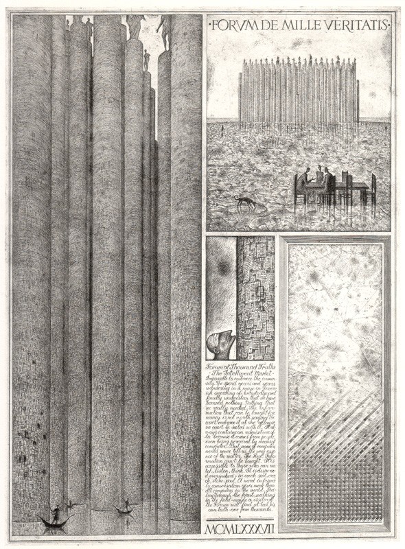

Source: The Nonist

Perhaps, after all, there is something graceful and sensual in the slow loss of a city to the sea. Atlantis redux.

Gated Cities, Divided Worlds

by Katia Savchuk

You wouldn’t find Bucca on maps of Iraq six years ago, but by 2007 it had a population of 22,000. This vast U.S. army base is one of many “cities in the sand” that Americans have built from scratch to house and cater to troops, according to the New York Times.


With populations comparable to those of Ithaca, NY, or El Cerrito, CA, and amenities like sewage systems, power plants, fire stations, hospitals and even Subway outlets, the bases are truly artificial cities. They stand worlds apart from the Iraq outside their gates, boasting clean streets, sanitation, working electricity, potable water, relative safety – and an occasional visit from NFL cheerleaders. Thousands of workers from Uganda, Bangladesh, the Philippines and India live in isolated portions of these forts, interacting minimally with Westerners; the real Iraq is completely excluded.

There is a parallel between these gated islands and the all-inclusive high-rise complexes springing up on the periphery of Indian cities, where those who can afford it create a self-contained world of manicured lawns, non-stop water and electricity, fitness centers, and shops. One such walled city – Hamilton Court outside of Bangalore – even has a private school on the premises. Security guards keep out the rest of the population, except for servants who wash floors and cook meals during the day and return to the slums that cluster around the complex at night. These, of course, lack the most basic facilities and public services.


Although these spatial dichotomies may be tied to the effects of neoliberal capitalism – and resulting conflicts and growing inequality – they seem to be a regression to colonial or even feudal spatial configurations, with fortified bastions of wealth served by a native population living in poverty outside the gates.

Literally inhabiting two separate cities is probably the pinnacle of spatial inequality. This stems from inequalities of class, income, education, nationality, etc., but I think that once established, it has consequences that supersede the initial bundle of inequalities. In the case of India, privatized communities monopolizing the resources of wealthy citizens makes it much more difficult for public services and investment to grow. It also seems that such spatial segregation cements differences, creating two enclaves that can only continue to diverge and whose boundaries become nearly impossible to breach.

Credits: Photos of Iraq and Mumbai from the New York Times.

Bright Lights, Big City

by Vivien Park

“There are two kinds of light - the glow that illumines, and the glare that obscures.” — James Thurber

I recently came across a point-counterpoint style interview with a lighting designer and a dark sky activist on the subject of light pollution. It’s a fascinating topic that touches on energy consumption, aesthetics, safety and the effect on ecology. The conclusion of this interview is that a middle ground exist within thoughtful lighting design. With better light bulbs, regulations, and placement of light we just might be able to solve everyone’s needs. The two-part interview can be found here and here.


Interestingly, an argument for dark sky activism is the preservation of cultural heritage as well as inspiration for the arts. However, as an artist, I find myself increasingly drawn towards outdoor light projections as an art form. Artists such as Barbara Kruger, Jenny Holzer, and Tony Oursler have all utilized this ephemeral medium in various ways. Many of the works display political messages in monumental scale, while some simply augment the appearance of a building in a seemingly magical way.


Outside the realms of lighting design and dark sky activism, whether lighting is considered glow or glare is somewhat dependent on perspective. I’m thinking of the beauty found in aerial shots of nighttime skylines, in curtains of light projected at outdoor cinemas, and in holiday lights that outline trees along city streets. There is something mysterious and dramatic about light surrounded by darkness. Perhaps it’s not just a matter of more or less light, but a presentation of intervals and contrasts that can raise the light bulb past its utilitarian status.

Hyper-Extensions: The Marmaray Project

by Christina Yessios


1 View of Bosphorus


2 View Camlica Hill

“The Amazons will set you on your way
and gladly; you will reach Cimmeria
the isthmus, at the narrow gates of the lake.
Leave this with a good heart and cross the channel,
the channel of Maeotis: and hereafter
for all time men shall talk about your crossing,
and they shall call the place Cow's-ford.  

(Bosporous/Βόσπορος)

Leave Europe's mainland then, and go to Asia.”
(Aeschylus, Prometheus Bound)


The cow that crossed the Bosphorus was actually the young lover of Zeus, Lo, who he turned into a beautiful white heifer to protect her from his jealous wife Hera. Even so, Hera, realizing she had been deceived, demanded the heifer from Zeus and tormented her into madness by having a gadfly unceasingly chase her from place to place.

When Lo the cow comes upon Prometheus the titan where he has been chained to a rock by Zeus, knowing his ability to read the future, she asks him what the extent of her journey will be. He eventually agrees to tell her that she will have to cross a channel to travel to the land of the Amazons and in due course come to rest in the land of the Nile.


3 Map of Istanbul 1838


BRIDGING:

The body that divides the East from the West, Europe from Asia, the Bosphorus, has always defined the character of the city, spanning 3,700 m to 700 m at its narrowest, and 30 km long. The first recorded bridge to cross this strait was constructed of boats and commissioned in 490 BC by the Persian emperor Darius, linking the temple on the mouth of the Black Sea (Pontus Euxeinos) and the Bacchus temple near the Marmara Sea (Propontis). During Ottoman rule engineers dreamt of constructing a bridge once again that would follow the coordinates of Darius’ bridge and carry railway across. Two bridges were planned, one between Sarayburnu and Üsküdar, and the other between Rumelihisarı and Anadoluhisarı very proximate to today’s Second Bosphorus Bridge. However those plans were rejected by the Sultan Abdülhamit in 1878 as was the proposal a couple years later for an underwater tube bridge.


4 Proposal 1860

Again in 1931 a proposal drawn up by the first plane manufacturer in Turkey, Nuri Demirag, to link Ahirkapi with Salacak, modeled on the San Francisco-Oakland Bay suspension bridge, was approved by Ataturk but was rejected and deemed impossible by the Minister of Public Works. Finally on July 3, 1967 after a decade of existing in discussion at an official level, the Turkish Grand National Assembly put in place a law on the works of the First Bosphorus Bridge, linking over 1560 m, Ortakoy on the European side with Beylerbeyi on the Asian side. In 1988, the second gravity-anchored suspension bridge was constructed across the strait to deal with the unprecedented mobility within the city. Bridges across the Golden Horn, the other inlet of water in Istanbul, have existed continuously since 1845. The current Galata Bridge is the fifth bridge built in its place after the previous four were destroyed for various reasons.

MOBILITY to Urban Project:


5 Tram crossing Galata Bridge


6 Transportation


Today 330,000 vehicles cross the Bosphorus bridges daily, while the same number of passengers use ferry transport throughout Istanbul. Over a million passengers a day travel on a rail network of 138 km, while 591 bus routes and 123 minibus routes service 5 million passengers on a network of 6,100 km. At the same time there has been a large increase in motor vehicle use and motorized travel time; currently there is 35% car ownership that is projected to increase to 65% by 2023. Today only 4.6% of motor transport is rail, compared to 60% in Tokyo, 31% in New York City, 22% in London and 25% in Paris.


7 Istanbul, 1968 land use


8 Istanbul, 200 land use

What does this mean for Istanbul as a living space and city? Thirty-five years ago the Bosphorus was only crossed by boat and since the population has quadrupled. New urban infrastructures are being constructed in the city to further mobilize its citizens: In 1989 the first light rail was constructed, in 1990 the tramline, and in 2000 the first subway line. Currently the Marmaray Project is near completion and due to open in 2012. The Marmaray tunnel is part of a larger project that includes updating the existing train lines and 37 existing stations, creating a new continuous line from Gebze to Halkali. It is over 76 km long and adds a third line parallel to the existing to increase capacity, while bringing to life the 1860 idea for a bridging tunnel under the Bosphorus Strait.


9 Marmaray project

One point four kilometers long, the new Marmaray tunnel will be submerged 60 meters below sea level, 55 meters of water and 4.6 meters of earth, constructing the “deepest undersea immersed tube tunnel” in the world. The new tunnel will carry 70,000 passengers per hour across the Bosphorus in 4 minutes, while travelling from Gebze to Halkali will be reduced by forty minutes, totaling 105 minutes. It is projected that the use of rail transportation in Istanbul will rise from 4.6 % to 27.7% after the new train line is fully constructed.


10 Marmaray tunnel section


11 130 m tunnel sections

The Ministry of Transportation has laid out the following objectives for this project:

(a) provide a long-term solution to the current urban transportation problems of Istanbul;
(b) relieve existing operating problems on the mainline railway services;
(c) provide direct connection of railway system between Asia and Europe
(d) increase capacity, reliability, accessibility, punctuality and safety on the commuter rail services;
(e) reduce travel time and increase comfort for a large number of commuter train passengers;
(f) provide an uninterrupted passenger and freight transportation across the Istanbul Strait;
(g) reduce air pollution resulting from the exhaust gases and thereby improve the air quality of Istanbul;
(h) reduce airborne traffic noise in the centre of Istanbul; and
(i) reduce adverse effects on historical buildings and heritage sites by offering a potential for reducing the number of cars in the old centre of Istanbul.

UNEARTHED:


12 Excavation site


13 Excavation site

While the Marmaray project is taking Istanbul into its future it is inevitably a great reflection on its past which must always be considered as many layers within the current condition. Excavation for a new central transport hub at Yenikapi, currently a ferry port and metro station, was envisioned to extend down to the Marmaray tunnel and expand to include light rail, creating a large intersection of infrastructure in the city. Beginning in 2004 the excavations accidentally came upon and unearthed the lost Byzantine port of Theodosius I from 4TH century AD, including over 37 Byzantine ships from 7th to 11th century AD, the largest to date over 40 m long.


14 Excavation site finding

The excavations site now extends over 58,000 square meters, about 10 city blocks. The ships found are all in a state of wreckage that experts believe was caused by a tsunami like storm a thousand years ago. The advantage is that the ships were well preserved in the sand slit they sunk into and have all their details intact that can bring to light the ship building techniques of their time. Aside from the port, part of the Emperor Constantine’s city wall has been found, the remnants of an Ottoman bazaar that was built over the port and other artifacts from Istanbul’s original settlement, going back to 6000 BC proving Istanbul’s history to date back further than known before.


15 Yenikapi excavation site

While the ships are being moved off the site to be analyzed the Marmaray project is being delayed two years and future of the site is for the most part undetermined. What is certain is the need to reconcile the richness of Istanbul’s fabric and urban contexts with the hyper activity of the new infrastructures being imagined and built. Beyond the Marmaray project, looming statistics of the growing population, car use, energy use, and congestion, have other projects in line such as a third Bosphorus bridge which has been approved, and a proposed Bosphorus car tunnel, as well as urban road tunnels and flyovers. The Yenikapi station site is an example of the uncertainty of the intersection of these infrastructures with other events in the city. The imagined station proposals appear static and sterile in relation to the larger frame of the urban project. An interior urbanity is needed for the new subterranean spaces of the city that can negotiate with a flexible framework the overlapping zones of proposed archeological park, train stations, transfer point, and public corridors.


16 Proposed Yenikapi station

Credits: (1-2, 5) by the author; (3) stock-images.antiqueprints.com; (4, 9, 10, 11) marmaray.com; (6, 7, 8 ) "Urban mobility and energy trends in Istanbul," euromedina.org (pdf); (12, 14, 15, 16) "Uncovering Yenikapi," saudiaramcoworld.com; (13) Google Maps.

Do You Know a Place in a City …

by Natalia Echeverri

"The Guide to Open Places" is part of the 4th International Architecture Biennale Rotterdam, which opens on September 24th, 2009 and will be going until Jan 10th, 2010. The theme of this year’s biennale is Open City: Designing Coexistence. Through themes of squatter, community, refuge, collectiveness and reciprocity the biennale examines the city from the point of view of the designer. Three exhibitions and a series of workshops, forums, screenings and debates will be held in Rotterdam and Amsterdam.


The project Guide to Open Places, is part of the forum exhibition in the Netherlands Architecture Institute (NAI) and it is now searching for open spaces in cities around the world that can be displayed in the Biennale. You can be part of this by posting online at http://www.open-places.com any open place that you think should be included in the guide. “Open places”--as defined by the curators--“can be used in multiple ways, need interaction to become alive and describe a spatial condition, which can be a public space, a building or an urban ensemble.”

Open Places are divided into three categories: temporary places, existing places and former open spaces. An example of a temporary open place posted on the guide are the sites of PARK(ing) Day, which for one day, transformed parking spaces into public parks in San Francisco and around the world last week.


There are many existing open places posted on the map. An unexpected example is the soccer field in the middle of the favela in Sao Paulo. Due to the importance of soccer in Brazil’s culture these open public spaces are respected and never squatted even though they sit on some of driest and flattest land of the favela. This is perhaps the most dramatic proof of how useful public space is valued and protected by its users.


I posted the Barcelona neighborhood of Poblenou, which I consider a former open place. When talking about Poblenou it is important to understand the context of Barcelona’s continuous changes. During the last thirty years Barcelona’s urban design transformations have received high international recognition. The end of the Franco regime in the mid 1970’s introduced democracy and sparked Barcelona’s renaissance, in which a stagnating post-industrial city became a renowned urban-planning precedent: the “Barcelona Model.” Through democratic policies, new plazas, parks and streetscapes were implemented, ridding the center of blight and repopulating abandoned areas and strengthening the city in general. The 1992 Olympics brought even larger urban improvements and brought the city international attention.


In the first half of the 20th century, Poblenou was a working class quarter at the edge of Barcelona. It once housed the most important industries of Spain but with the industrial decline of the 70’s many of its factories were abandoned and left vacant, leading the neighborhood into a decline. These spaces were eventually occupied by artists and entertainment businesses, which gradually revitalized the neighborhood. This layered occupation and reuse of the area contributed to a new, free-spirited identity. Later on, for the 1992 Olympic Games, the Barcelona city government tried to integrate Poblenou with the city, by incorporating part of the Olympic developments into the neighborhood. This led to further transformations that have all but erased its proletarian history.


With the economic downturn after the Olympics, a political shift to the right favored the private market, changing the paradigm of the “Barcelona Model”. Neoliberal policies were applied at the urban scale. The extension of the prominently axial Diagonal avenue, from Plaza de las Glorias to the waterfront is flanked by a collection of privately sponsored developments, transforming Poblenou, a neglected industrial town, into a chicly branded neoliberal development. Consequently, through the process of gentrification, the original proletariat population and the artists who once gave life to the area have been forced away.

Spanning from Plaza de las Glorias and Jean Nouvel’s Agbar Tower to the waterfront at the Barcelona Forum 2004, the so-called @22 is one of these new developments dedicated to information and communication technology and luxury housing. These privatized residential-business-leisure-consumer developments generate a new type of public space, which is highly monitored and controlled.


Parc Central of Poblenou, which opened in 2008 as a part of the @22 development, is a prominent example of these privatized spaces. Designed by star architect Jean Nouvel, the park represents a paradigm shift from the urban democratic policies of the “Barcelona Model” towards one of private enclosures. It is a fortified enclave surrounded by over 1000 meters of walls (with a few glass portals) that deny not just the unwanted visitor, but even the ability to see. It is as if the park were designed only to gaze upon from within the new towers that surround it. As its heritage disappears into the glassy skyscrapers, gated park and super malls we realize the loss of a truly Open Place. Poblenou and Parc Central are not the only actors in this phenomenon. It is Barcelona that has changed dramatically. As an architect and a planner I have always admired its great architecture and planning strategies; now I view it with disappointment, as the great social agenda has disappeared and the city is remade for investors and tourists.

Credits: Images from Natalia Echeverri.

In Suspense

by Andrew Wade

As I sit in suspense over the Atlantic, between London and New York, I am reminded of the importance of airports in contemporary cities. With global air traffic increasing the connectivity of cities and the rate of exchange of human capital, the airport becomes the gateway through which we enter a unique urban environment. It has become essential for cities to upgrade and modernise their airports to both handle increased volumes of traffic and project an appropriately modern and sophisticated image to passengers.


Heathrow Terminal 2 Proposal. Source: The Architects’ Journal

London Heathrow’s new Terminal 5 succeeded in doing just that, employing a big name in Richard Rogers Partnership to design a much needed expansion for the world’s busiest international airport. Airport design often allows a grand opportunity for an architect to make a statement — an idea which is explored in this series of photographs. The sheer size of modern passenger terminals provides the opportunity to play with structure and light at such scale as to create a very powerful experience.


Beijing Terminal 3. Source: Thewamphyri

The program for airport terminals is becoming so demanding and complex that we are experiencing a phenomenon of a select few architectural firms designing nearly all of the new terminals around the world. It is hard to come by a more clear and striking image of globalisation than seeing airports in Philadelphia, Abu Dhabi, and Tianjin all designed by the same company. It is nearly impossible to win a commission these days without a wealth of experience and an extensive portfolio in transport design, which reinforces the dominance of a few prominent designers.


Heathrow Terminal 5. Source: Terminal5insider

The sense of arrival granted by the contemporary airport is reflective of the modern global city — stressing technology, sensory overload, and a certain sanitised quality in a world of hyperspeed. With the connectivity of cities only set to increase, we are likely to see the modern airport reach ever larger scales, while our unavoidable desynchronosis only adds to the delirious effect.

Art + Power + Space

by Peter Sigrist

Picking up on Ivan’s reference to Gordon Matta-Clark, I’d like to consider relationships between art, power and space. The term anarchitecture, as commonly associated with Matta-Clark, provides an interesting way of thinking about these relationships. In connection with a recent AIA event on art and architecture, it implies a sort of freedom from client specifications. James Attlee sees a response to high-modernist rationalism, as well as the foundations of a more iterative, collective, locally contingent approach to architecture. He finds that Marcel Duchamp, Jane Jacobs and “self-built shanties” may have been important influences.

photo of children, homes and shops in Mumbai’s Dharavi settlement
Source: Peter Sigrist

Anarchitecture isn’t necessarily a subversion of order. While chaos may result from anarchy, it isn’t part of the word’s original meaning. If “arch” is derived from the Greek word for chief, then anarchy would mean without a chief. In that case, anarchitecture could mean building without a chief or without a single chief. Even the most powerful person is dependent on many variables, from basic food and water to heart and lungs, technology, finances, subordinates and ideas. This suggests a more inclusive notion of power.

Art has supported and threatened concentrations of power. It is utilitarian even when simply making a statement. It is not only the province of Duchamp and other artists. In its broader sense (the conscious use of skill and creativity), it can be found in movies, athletics, business and governance. It involves communication, inventiveness and coordinated actions. Art and power are closely related, playing important roles in the transformation of space. Matta-Clark’s anarchitecture offers brilliant ways of engaging with this process.

It’s PARK(ing) Day

by Katia Savchuk


Source: Stina Jonsson

Today is the fourth annual PARK(ing) Day, a one-day event during which activists, artists and others so inclined take over metered parking spots and temporarily turn them into small parks or other public spaces, like art galleries and health clinics.

Since Rebar — a studio combining art, design and activism — pioneered the event in San Francisco in 2005, it has become a global tradition. Last year, participants created over 500 installations in more than 100 cities on four continents.

For Rebar, “PARK(ing) Day is about reimagining the possibilities of the metropolitan landscape,” especially car-oriented urban infrastructure. It sounds fun (although anyone attempting this in San Francisco should beware of our ever-stealthier meter maids and lofty fines).

Planning for Shrinking Cities

by Anna Fogel

Today, every sixth city in the world can be defined as a shrinking city. In the United States, these were once the dominant cities of the country, the top producers in industry and manufacturing with growing populations and in-migration, such as Flint, Michigan, Youngstown, Ohio or Richmond, Virginia. However, as the heyday of steel and other industries ended in the 1960s and factories closed throughout the 1970s, these industrial cities were left financially helpless. Practically overnight, the economic infrastructure of entire cities disappeared – thousands of jobs and careers, civic leaders, community-building institutions. In the USA, more than half of the 100 most populous cities in 1950 have fewer residents today, though the national population has doubled in that time. Shrinking cities, barely economically sufficient in the best of times, are hit extremely hard by the recession.

What is a “shrinking city”?

Berkeley’s Symposium on Shrinking Cities broadly defines the category to include cities, parts of cities or metropolitan areas that are experiencing a dramatic decline in their economic and social bases. There are numerous negative influences on these cities, including globalization, the post-industrial shift from manufacturing to service industries and the “second generation” of the high-tech sector after the bursting of the dot-com bubble. Lorlene Hoyt, a professor of urban planning at the Massachusetts Institute of Technology, specifically describes cities in this category with three criteria: First, the cities must be old with an industrial history, which she defines as having more than 5,000 inhabitants by 1880. The cities must be small, with populations between 15,000 and 150,000. Lastly, the cities are all poor, with median household incomes of less than $35,000.

The Berlin-based “Shrinking Cities” project reports that during the 1990s more than a quarter of the world’s large cities saw population declines, mainly in post-socialist Europe and America, but also in Japan, Russia and China, as the population shifts to major, thriving cities, from many of the smaller cities. The concept of shrinking cities is more common and established in Europe, which has considered the phenomenon for longer.

I became interested in the idea of a shrinking city after living in Youngstown, Ohio last fall while working on Obama’s campaign. Youngstown, a city in northeastern Ohio, is an extreme example of a shrinking city, with a population today that is half the size it was in 1950. In the 1950s and 1960s, Youngstown thrived with 168,000 people, depending heavily on the steel industry. However, in the last thirty years since the steel mills have closed, Youngstown is known for a strong mob influence, political corruption and as a way-station between the larger near-by cities of New York, Pittsburgh, Cleveland and Chicago. In 2002, born out of a partnership between the city of Youngstown and Youngstown State University, Youngstown 2010 was developed. This plan, created with the contribution of thousands of city residents, is an economic and urban development plan that acknowledges Youngstown’s “new reality”, as the plan explains, as a smaller city with a population of approximately 80,000. Youngstown 2010 is viewed as one of the preeminent national approaches to addressing and planning for shrinking cities.

While shrinking cities face many obvious challenges, they also have inherent assets. Many of the cities’ amenities originated in their historic dominance. Often the cities, like Youngstown, were initially well-planned, with extensive infrastructure and public services. The cities often have regional or national transportation access, located on railroads or rivers, because of the initial needs of the industrial economies. There is stunning architecture and cultural institutions, such as museums, universities and symphonies, developed and well-funded during the cities’ prosperous decades. The cities are more affordable to live in than their larger neighbors. Jay Williams, the Mayor of Youngstown, describes the seemingly paradoxical presence of these amenities in the face of the major challenges Youngstown faces: “Where else do you see dilapidated buildings across the street from the home of the symphony? Where do you have wonderful museums and an exceedingly high crime rate? There is a growing university and a struggling K-12 school system.”

Youngstown began its planning process with the goal of creating a smaller, well-planned and sustainable city. One of the most important steps in pursuing and developing an economic development plan is understanding and embracing their current city. The first two goals of Youngstown 2010 are: “accepting Youngstown is a smaller city” with an oversized infrastructure and many abandoned properties and “defining Youngstown’s role in the new regional economy” which necessitates moving away from the past steel-dominated economy.

Establishing viable neighborhoods in Youngstown, a key theme of Youngstown 2010, has two sides – developing and sustaining more vital neighborhoods and reclaiming the neighborhoods that are irreplaceable. As explained in Youngstown 2010, the population has declined at a much faster rate than the reduction in housing units. This has resulted in abandonment and looting, and the vacant homes become places for criminal activity, decreasing the safety and property values of the surrounding neighborhood. Mayor Williams sharply increased the budget for demolition during his time in office, and the city is planning to stop investing in resources to develop certain areas. This allows the city to decrease the size of the infrastructure to one that is more appropriate for the current population size and demolish abandoned homes to ultimately create additional green spaces.


Figures 1 and 2. The top figure is a map of the current landuse in Youngstown, developed for Youngstown 2010, and the bottom figure is a map of the future landuse in Youngstown, showing a smaller, consolidated city, with additional green spaces and parks.

These plans, while envisioning a better and more sustainable Youngstown, are controversial in their implementation. The sacrifices and hard decisions that must be made place the burden predominantly on the poor and minority residents. The neighborhoods are segregated, mainly by socioeconomic status, which has developed into extreme racial segregation. Youngstown 2010 and Mayor Williams’ strategies allow certain neighborhoods to empty by not rescuing or restoring abandoned houses and cutting off public services to unsustainable areas. John Russo, a professor of labor and working-class studies at Youngstown State University, asked: “You always have to ask yourself: ‘What areas are going to be abandoned?’ And most of those are the African-American parts of the city.”


Figure 3. Abandoned home in Youngstown

The plan attempts to limit the blight and abandonment that has seemingly taken over Youngstown to only certain neighborhoods, in order to save the other parts of Youngstown. In the longer term this may make sense, but it shows a lack of understanding of the current pain of living through these proposals. While the city has not forced anyone to move, it also leaves many of its citizens to live in neighborhoods that are rotting from the inside out. It deserts those that have the least resources to cope. Foreclosure rates have skyrocketed as entire neighborhoods of homes have declined in property value, and have left families with nothing. While the proponents of the plan argue that in the long-term it is pointless and perhaps impossible to revive certain neighborhoods, the implementation abandons many of the residents who still live in these neighborhoods.

Figure 1 and 2. Youngstown 2010 Plan
Figure 3. Photo by Anna Fogel, October 2008

Charity vs. Development

by Jordi Sánchez-Cuenca

Every year, with the aim of alleviating poverty, hundreds of millions of US Dollars and Euros are mobilized by governments and NGOs in the global North to build housing and infrastructure for the poor in the global South. However, much, if not most, of these funds do not deal in any way with the reasons why hundreds of millions of people live in extremely precarious houses, without the most basic infrastructure services and are permanently terrorized by the possibility of being forcedly evicted. This sort of aid is normally done in the name of Charity, a gigantic phenomenon through which government and well-off families in the North relief their ashamed consciousness. This massive display of well intentioned altruism, more often than not, does not achieve its objective: alleviating poverty. It rather alleviates global North’s sleeplessness.


He and his neighbours need more than a new toilet. Image source: Whale


This does not mean that there should not be donations and altruism, rather the contrary. The problem is a conceptual one; it is a matter of the approach through which their donations are made use of. Experience tells us that charity, more than anything, means applying patches on the system failures. Charity rarely leads to development, because its effects rapidly disappear, it substitutes the role of local governments in serving their citizens and becomes an excuse for authorities to skip their responsibilities, it easily ends up benefiting those who do not need aid and it often creates a perverse self-perpetuating dependency between poverty and arbitrary goodwill.

If altruism is to meet its objective, it needs to assimilate that development means change in the broad sense, not just foreign-paid construction. Development aid aimed at alleviating poverty in the long run, first, implies challenging structural forces that perpetuate poverty; second, it implies institutionalizing democratic processes through which power is decentralized towards a fairer and more transparent use of public resources, which means involving the poor in choosing priorities and sharing the responsibility of such choices; third, it implies capacitating local governments in managing public affairs in a more democratic and efficient manner; and it implies capacitating the civil society in getting involved in an organized and effective manner. In short, all efforts aimed at relieving the poor from their lack of adequate housing and infrastructure should have participatory democratic governance as its main component.

Identity and Invisible Infrastructure

by Ali Maddad

Reading about Mohammad Boota, a Ramadan drummer, I'm reminded of how rich an ethnic enclave "Litte Pakistan" is in Brooklyn's Coney island. Inspired by a conversation with colleagues who frequent the area, I spent some time exploring this neighborhood over the summer; I was increasingly curious of the stories of a targeted Pakistani community whose neighborhood is under surveillance. My initial inclination was to study the effects a heavily surveilled community and neighborhood has on the psychology and identity of its inhabitants.


However after spending time in the neighborhood and meeting with several inhabitants and groups, I amended my original proposal to focus on the community; surveillance became an increasingly smaller component. A process blog, re.scty.org, acts as repository for stories, news items, media and general progress for my project. I am particularly interested in using the lens of graphic design to an enact a psychogeographic study of the Little Pakistan neighborhood in Coney Island, Brooklyn. I want to explore facets of identity, community and urbanism in this targeted ethnic neighborhood. Tiered in three phases:
  1. Immediately post 9/11 
  2. Present day 
  3. Future scenarios


In the wake of 9/11, this neighborhood has been targeted by Homeland Security and the FBI. Myriad undocumented residents have been arrested; warrantless searches and arrests were conducted. The intimidation and fear prompted many residents to voluntarily leave for other boroughs — and in a few instances to Canada. The attrition in the community is plainly visible: empty stores and streets for a once busy and bustling neighborhood. Unintended consequences, include women being left alone at home, for increased fear of venturing outside; increasing incidence of youth gang related actives. And most persistent is the rumors of hidden and invisible surveillance.


I intend document the present localized set of cultural and social conditions and project forward a vision of urban renewal and re-engagement. As a necessary part of creating an emergent profile of the neighborhood I want to engage with the community: interviews, events, workshops, surveys and collaboration; collecting statistical and data-driven information: GIS, mapping, databases, demographic information and surveillance zones. Culminating in the creation of a 'visible' city with attendant identity that reflects the character, stories, history and issues in the area.


While this project is still in its infancy, I hope to continue working on it over the course of the year. My approach is growing out of the discipline of graphic design, identity formation via form giving, which finds some companionship in the social sciences and in urbanism and some architectural theory.

Credits: Photos by Ali Maddad. For more from this set, see amaddad.

Voiding Concrete and Watery Voids

by Ivan Valin


If the sidewalks of San Francisco feel a little more crowded these days, it's probably because there is a little less sidewalk for us to occupy. But, as it turns out, there is now a little more space for water to find its place in the ground instead of down a storm-drain as it moves across the urban hardscape. PlantSF, the organization that started the permeable sidewalk movement in S.F. continues to shepherd hydrologically forward-thinking San Franciscans through the red-tape and green-thumb difficulties of removing a piece of the city's concrete.

PlantSF didn't invent this process, they localized it. This is the critical step in turning these locally initiated interventions into a water management system that functions at the scale of the city.

But what if the problem of creating permeability in the urban surface were given the funding on the scale of a waterfront restoration project? After all, cities are brimming with these. We have already mentioned a few on this blog. Half of all the awards given this and last year by the American Society of Landscape Architecture for planning projects were river or coast revitalization projects. Big projects like the East River Waterfront Esplanade, the Toronto Central Waterfront and the Los Angeles River Revitalization are posed as centralized offerings of public space, alternative means of circulation and recreation. But couldn't — or shouldn't — the same public space be provided, in distributed fashion, throughout the city? Big urban waterfront projects make an attempt at hydrological and ecological sensitivity. But aren't they as likely to sever these systems by circumscribing a system that functions in terms of surfaces and watersheds? In short, I am arguing that big waterfront projects are soooooo 20th century and that now it is critical to amplify the efforts started by organizations like PlantSF in order to bundle the needs of communities with the needs of the urban/social/hydrological/ecological system. We need more jack-hammers and shovels. And we need to get a little Matta-Clark on our streets and sidewalks.


A Brazilian architect working in São Paulo proposed a fantastically anti-mega waterfront project at the 2007 International Architecture Biennale in Rotterdam. I interviewed the author, Fernando de Mello Franco, at his office then about the project and have recently revisited his work as it has evolved over the last two years in international lectures and seminars. In particular, I have been interested in how he has refined the political and economic strategies that the project triggered.

The existing infrastructure of São Paulo is a product of the landscape. In a city spanning ridges, transportation networks and their attendant industrial development followed--and ultimately transformed--the floodplains in the valleys offering ideal grades, access to water, and unclaimed territory. Rail, hydroelectricity, roads--the instruments of production and wealth in the city--were concentrated along these arteries. Fluid though the infrastructure was, it divided the city into a "constellation of discontinuous sectors". The periphery filled in but was unable to access these cores of the productive city.


After a century of uncontrolled growth the peripheries began to matter. With most of the ground occupied, the water catchments became impervious. Water moved quickly from the ridges of the periphery to the lowest spots in the city. The flat valleys and all the low-lying transportation and service corridors were subject to periodic flash-flooding, which in turn crippled the productive economy of the city. Instead of increasing the capacity of the low-lying rivers at the center of the city, the government sought a long-term solution and decided to restore some measure of permeability back to the city by excavating the periphery.


The city is halfway through building 131 of these retention basins, in portuguese "piscinões" — literally "big swimming pools"— that will draw excess water from overflowing streams and detain it \long enough to diminish the surge volumes of water arriving at locations downstream. Because of the uncontrolled growth however, the pools must be 'extracted' from the existing urban fabric: homes must be relocated, roads realigned, community assets replaced. For hydrological, but also for economic and practical reasons, the piscinões constructed or planned fall largely in the poor, peripheral areas of the metropolitan region. In effect, the issue of flooding (which is largely a problem of the center and of the formal sector) is being resolved in areas that stand to gain the least from that solution.


With a proposal entitled "Watery Voids" Fernando argues that this network of piscinões and the logic of flood control can be an opportunity to introduce a landscape-based urban structure in these informal areas. Investments to protect the center might be used in such a way that combines with other works in the area (like housing projects and mini water treatment facilities) to offer a more amenable solution within these communities. Instead of the craters that are now built, Fernando imagines strings and bulbs of greened subtractions that reorganize settlement around a working landscape. What's more, the maintenance and operation of these infrastructural landscapes might legitimize local organization centered on each sub-watershed.

I hope that Fernando's vision gains traction in São Paulo and that as we build responsible hydrological system in our own cities we might find such fortuitous hybrid solutions.

Credits: Gordon Matta Clark's Conical Intersect was found at artnet.com. The black and white aerial of the bundled infrastructure in S.P. is by Nelson Kon and found here. The photographs of the piscinoes were taken by the author. Fernando's plan is part of his presentation at the Urban Age Conference, which can be downloaded here.

Democratic Space: From the Globe to Your Local Library

by Katia Savchuk

Today is the International Day of Democracy. At least on paper. The United Nations declared September 15 to be Global Democracy Day two years ago. Like most ambitious dedications that line the white squares of the calendar, its most fruitful function is probably to serve as a cause for reflection.

The state of democracy — like much else — plays out tangibly in the physical environment of the city, the ways in which it is distributed and regulated, and the ways in which conflicts about it are managed.

In the U.S., regulations do hold sway and stakeholders have their say, but capital is king and class and race have historically limited choice of and ability to influence one's environment. In much of the world, unwritten rules, informal networks and under-the-table transactions play a big role in the governance and development of city space, reflecting their pervasiveness in all other spheres of government. In post-colonial cities, landholding patterns and control mechanisms bear vestiges of a heavy-handed past — just as they weigh down administrative and governance structures. Where there is no democracy to speak of, the environment is also the site for and manifestation of imposed practices and ideologies. The democratic space and the city space reflect each other.

Paraphrasing President Obama's recent description of the goals of civil society, Ingrid Srinath — Secretary General of CIVICUS — defines democracy as "the freedom of people to live as they choose, to speak their minds, to organise peacefully and to have a say in how they are governed; a free press to report the truth; confidence in the rule of law and the equal administration of justice; a government that's accountable and transparent."

A small local conflict over city space can be an opportunity to gauge the level of spatial democratization. In the Bernal Heights neighborhood in San Francisco, the local library is undergoing renovation, and its aging mural has become a site of contestation. Commissioned by the city and completed by artist Arch Williams with neighborhood youth and volunteer artists in 1982, the mural depicts historical figures, Hispanic and black children and other scenes on three of the library's facades.


The Library Commission had been discussing the fate of the mural with local residents since 2002, with options including preserving all or part of the mural, replacing it with a new mural, or replicating the existing mural indoors. In the end, there was no clear consensus, and the Commission recommended that the San Francisco Arts Commission — which must approve alteration or removal of art on city property — restore only the better-preserved mural on the front of the building and paint over the rest.


This has upset residents on both ends of the spectrum. Some community organizers and residents feel that the entire mural should be retained for its cultural and historical value — including its symbolic value in a gentrifying neighborhood — and that library authorities are responsible for the lack of maintenance that led to its decay. Other residents, including one representing Bernal Heights in the Council for Neighborhood Libraries, feel that the mural is not "art-worthy," takes away from the historic building, and is beyond repair. The SF Arts Commission will examine the issue this Wednesday (the meeting is public, by the way) and issue its final vote next month.


If this is a test case for democracy, it gets an A. Voters approved the bonds to renovate the library — a public resource. Local stakeholders are comfortable raising concerns and participating in discourse about the fate of the space. Citizens are well organized into associations and community groups. City Commissions with diverse members and expertise in the issues and governed by rules of accountability seek out different opinions and make decisions through transparent proceedings.

Conflict can seem negative, but it is inevitable — especially when it comes to something as scarce, visible and shared as public space. The way that concerns are voiced, decisions are made and conflicts are resolved, however, can (sometimes) be truly democratic.

Credits: Rendering of the new library from SF Public Library website. Photo of mural from Flickr user Thomas Hawk. Photo of residents from the SF Examiner.